The Thompson-Nicola Regional District (TNRD) has received $30,000 to help it do a review of evacuation routes throughout the region.
The funding comes from the province’s Community Emergency Preparedness Fund (CEPF), which is administered by the Union of BC Municipalities. The TNRD is one of 22 local governments and First Nations to receive funds totalling $909,000 to develop and update emergency evacuation routes and/or improve public notification planning.
Kevin Skrepnek, the TNRD’s manager of community and emergency services, says that the regional district started the process of reviewing its evacuation plans last year, tackling five of the TNRD’s 18 plans.
“The first five areas were where we’ve had incidents before, or which were at higher risk because of population or the risk of fire,” he explains. “We lumped various communities in together, because we looked at it based on potential evacuation routes and what the logical groupings are based on road access.”
The first five plans reviewed included areas around Lytton/Botanie, 70 Mile/Big Bar/Jesmond, Blackpool/Upper Clearwater, Pritchard/Del Oro, and Savona/Walhachin. Skrepnek says that the work involved the pre-planning of evacuation routes, taking into account the number of people in certain areas, what their various methods of egress would be, and how long it would take to evacuate a certain area depending on the nature of that area.
“Given that we’ve already got those five done and have a template in place, we’re fairly confident we can get the rest of the plans done with this funding,” says Skrepnek.
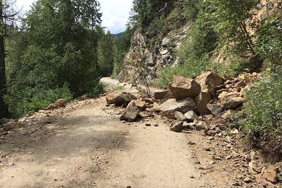
“The contractor will do a lot more of the ground-proofing, seeing what’s out there, what roads are passable. A big part of why we go through this process is that we don’t control any of these roads. The contractor talks to the road owner, like MOTI [Ministry of Transportation and infrastructure] or the Forest Service, to see what state Forest Service Roads are in. This factors in when we make decisions about where people go, which could be dynamic in terms of where the danger is. A community could have two routes out, but one could be compromised.”
Skrepnek adds that a lot of the finished product will revolve around mapping, which the TNRD has the in-house capacity to do.
“Having that capacity will help the process. We’ve expanded our GIS [Geographic Information System] team internally, and they do an excellent job. Their maps are easy to understand, and our public-facing maps are very accessible for folks.”
Work on the remaining 13 TNRD evacuation plans should be complete in time for next year’s fire season.

